Thursday, October 7, 2010

Trip to Vagamon And Pattumala Church


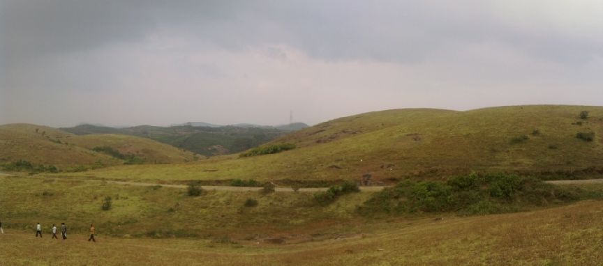
     Vagamon is a hill station located in Kottayam-Idukki border of Idukki district of Kerala, India. It has a cool climate with the temperature between 10 and 23 °C during a summer midday. It is situated 1,100 meters above sea level. Vagamon also known as the 'Scotland of Asia'. National Geographic Traveler has listed Vagamon on their directory of the '50 most attractive places to visit in India.

See more about Vagamon in below wiki URL:

http://en.wikipedia.org/wiki/Vagamon

Route Map from Thekkady(kumily):

Route 1:Kumily-Vandiperiyar(cover Pattumala)-Vagamon:
  
                                     
Route 2:Kumily-Anavilasam-Vagamon:


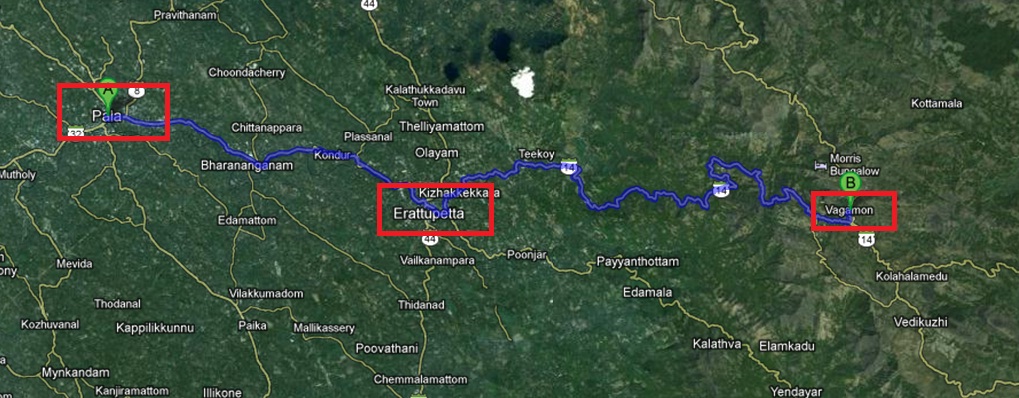
Pala-Barananganam-Erattupetta-Vagamon Route:


Rolling meadows of Vagamon

Kumily-Vandiperiyar-Vagamon route

Another Scenic Vagamon hills

Pine forest @ Vagamon

Another clear view

Kumily-Kottayam NH220

Kumily-Kottayam NH220

One specialty of Vagamon is that you will never get tired of Vagamon

Each visit will give you various moods

Pine valley @ vagamon hills

As usual KTDC is everywhere


The Pattumala Matha Church is a Roman Catholic church in Kerala dedicated to Our Lady of Good Health. It is served by the Congregation of the Missionary Brothers of St. Francis (CMSF). The church is built entirely of granite is a Marian pilgrim centre. It is situated in the midst of tea plantations. The name Pattumala means 'Hill draped in silk'. It is located 17 km from Peermade and 27 km from Thekkady. The church is on the way to Kottarakkara(also known as KK ROAD) from Kumily(NH183) and on the righ hand side of the road.

See more about Pattumala Church in wiki page:

http://en.wikipedia.org/wiki/Pattumala_Matha_Church


Pattumala Velankanni Mathi Church on Kumily-Kottayam Road

This is a granite-built church

Another close view

Pattumala Matha Pilgrim Shrine - Must visit place on such a lovely location

Complete front view from road



Trip to Thekkady & Mullaperiyar and Theni Ghat view

Thekkady (Idukki district) is the location of the Periyar National Park. The Periyar Wildlife Sanctuary is spread across 777 km² (300 sq. miles), of which 360 km² (139 sq. miles) is thick evergreen forest. The splendid artificial lake formed by the Mullaiperiyar Dam across the Periyar River adds to the charm of the park.


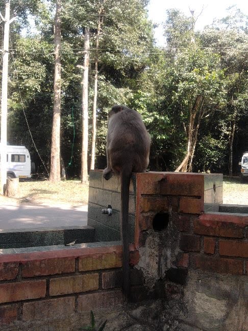
Very usual scene

This is a concrete sculpture that representing a Tiger

The famous thekkady boat launch and scenic Periyar lake

Kerala Forest Department information board @ thekkady

Entrance to Periyar Tiger Reserve

One of the resort at Kumily

Beautiful buildings, resorts all over

Kumily-Theni Ghat road

The Famous Mullaperiyar Hydroelectric power station

Huge Penstock Pipes carrying water to the Hydroelectric power plant

Valley view

Huge Penstock Pipes carrying water to the Tamilnadu Hydroelectric power plant

Big tree Root....

Comfort Station and various ticket reservation center @ Thekkady

Not much water its summer.

Tip to Nelliyampathy - Poor Man's Ooty....

           Nelliampathi is a popular hill station 60 km away from Palakkad in Kerala a small state in south India. It is surrounded by tea and coffee plantations and has excellent weather conditions. The journey to Nelliampathi itself is an experience. The only route is from Nemmara, from where the first town of Nelliampathi, namely Kaikatty junction, is at a distance of 26 km. At the 9th kilometer is the Pothundi Dam, a small irrigation dam which provides water for the rice fields in the surrounding area. The dam is at the foot of the Nelliampathi hills. From here, the road winds up for the next 17 km, with many hairpin turns on the way. Immediately after Pothundy dam, comes the government forest, where one can see massive teak trees. The road is very narrow and requires a skilled driver behind the wheel. On the way, one can see wild animals like monkey, deer and porcupine. The view of the Pothundy dam from the height is a breathtaking sight. There will be many waterfalls by the roadside during the rainy season.


For more Details please visit wiki page

http://en.wikipedia.org/wiki/Nelliyampathi


Route Map from Palakkad, Kerala:
Route Map


Such a lovely tree On the way near view point

Pothundi Dam- view from the hill

Pothundi Dam- another scenic view from the hill

Pothundi Dam- in the evening

Calm and traffic free Road to Nelliyampathy

As usual KTDC sign boards

You can see nelliyampathy hills

usual village pond at Nemmara

Forest check post starts here- nelliyampathy is a eco tourism sport

Another view of Pothundy irrigation dam

On top of Kesavan para or Kesavan Rock(Aparichithan movie location)

Poabs estate-they produce organic tea

Poabs estate outlet and tea shop near Seetharkundu

AVT manalroo estate on the side of Poabs

Early morning snap.


Misty nelliyampathy hills(Aparichithan movie location)

Long view of pothundy dam from Kesavan para(Aparichithan movie location)

This tree is famous in nelliyampathy

Such a lovely palakkadan valley view from Seetharkundu view point


Seetharkundu view point

A small pond at Kesavan Para(Aparichithan movie location)

Videos from KTDC: